
How do tornadoes form? Wind shear, a rotating updraft and what scientists still don’t know
Most tornadoes form when a thunderstorm’s updraft begins to rotate and a narrow, violently rotating column of air reaches from the cloud to the ground. Winds that change speed or direction with height roll the air into an invisible horizontal tube, the storm’s rising air tilts it upright into a rotating updraft called a mesocyclone, and warm, moist air feeding it near the ground can then let a tornado form. NOAA says that scientists do not yet fully understand the last step, and as few as 20 per cent of supercell thunderstorms produce a tornado.
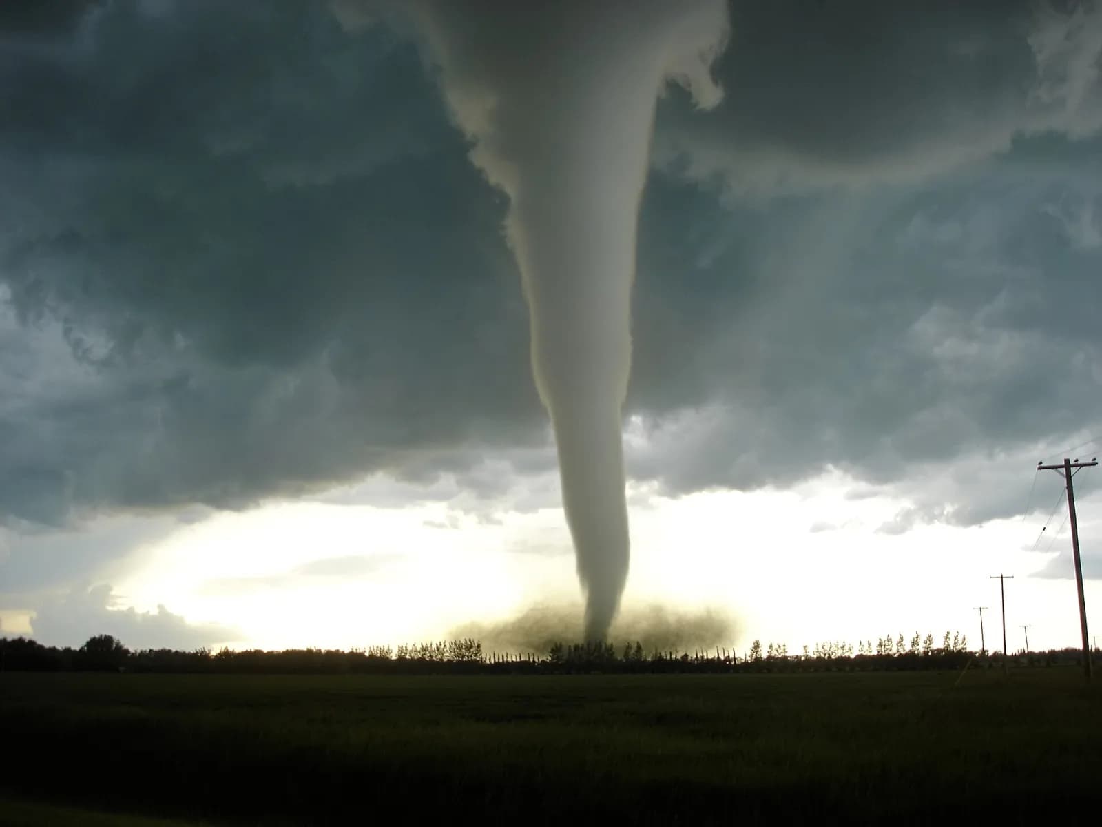
Tornadoes are among the most violent storms on Earth, and one of the least understood. This guide follows the standard recipe step by step, then says plainly what the National Severe Storms Laboratory still cannot explain. It also covers how tornadoes are rated, where and when they happen, and what official services such as NOAA and Ready.gov say to do when a warning is issued. It is general information; for your own home, follow your local National Weather Service office and emergency service.
Key ideas
- A tornado is a narrow, violently rotating column of air extending from a thunderstorm to the ground; the best-known recipe is wind shear, a tube of air tilted upright by the storm’s updraft, and warm, moist air feeding it.
- The most destructive tornadoes come from supercells, but as few as 20 per cent of supercells make one; nearly 20 per cent of tornadoes come from lines of storms, and landspouts and waterspouts are weaker.
- Tornadoes are rated by damage on the Enhanced Fujita (EF) scale, from EF0 (105 to 137 km/h) to EF5 (over 322 km/h); the highest wind ever measured in one was 318 mph (about 512 km/h) in 1999.
- About 1,200 tornadoes hit the United States each year; they occur in all 50 states, mostly between 4 and 9 p.m., and “Tornado Alley” is a media nickname that can mislead.
- A tornado warning means act now: go to a safe room or a small, interior, windowless room on the lowest floor of a sturdy building and cover your head and neck; there is no safe option in a car.
The short answer: shear, a tilted tube and a rotating updraft
Start with a thunderstorm in an atmosphere where the wind changes with height. NOAA gives an example: at ground level, slowed by friction with the surface, the wind blows from the southwest at 5 mph (8 km/h), but at 5,000 feet (about 1,500 m) above the same place it blows from the southeast at 25 mph (40 km/h). This difference, called wind shear, makes an invisible tube of air begin to rotate horizontally, like a rolling pin lying on its side.
Then the storm’s rising air, its updraft, tilts that rotating tube from horizontal to vertical, so the area of rotation extends through much of the storm. A rotating updraft of this kind is the key to a supercell, and the rotating circulation that radar can see inside it is called a mesocyclone. Once the updraft is rotating and being fed by warm, moist air flowing in at ground level, a tornado can form.
A tornado is therefore only a tiny part of a storm’s energy. NOAA notes that tornadoes account for only a small fraction of the energy in a thunderstorm, and what makes them dangerous is that this energy is concentrated in a small area, perhaps only a hundred yards (about 90 m) across. When the funnel is made visible by condensation of water droplets, dust and debris, it looks like a tube hanging from the cloud.
What scientists still don’t know
NOAA’s National Severe Storms Laboratory is blunt about it: how tornadoes form is not fully understood. Why does one supercell produce a tornado while a nearby storm that looks the same does not? As few as 20 per cent of supercells actually do. Recent theories from the VORTEX2 research programme suggest that once a mesocyclone is underway, tornado development is related to temperature differences across the edge of downdraft air wrapping around it.
But mathematical models show that a tornado can also form without such temperature patterns, and very little temperature variation was observed near some of the most destructive tornadoes in history, on 3 May 1999. The role of downdrafts and of the distribution of temperature and moisture in the first moments of a tornado, called tornadogenesis, is still being studied, and so are other sources of the circulation.
Not all tornadoes come from supercells. Nearly 20 per cent are associated with lines of strong thunderstorms called quasi-linear convective systems (QLCS), which frequently strike in the late night and early morning and tend to be weaker and shorter-lived. A landspout is a tornado with a narrow, rope-like funnel that forms while the thunderstorm cloud is still growing and there is no rotating updraft, so the spin starts near the ground. A waterspout is similar but over water. NOAA says the damage from these types tends to be EF2 or less.
How strong, how big and how long: the EF scale
Wind inside a tornado is hard to measure, because strong tornadoes destroy instruments. So since 2007 the National Weather Service has rated them with the Enhanced Fujita (EF) scale, which estimates wind speed from the damage. It uses 28 damage indicators, such as building types, structures and trees, each with 8 degrees of damage. The ratings and their estimated 3-second gusts are: EF0 65 to 85 mph (105 to 137 km/h); EF1 86 to 110 mph (138 to 177 km/h); EF2 111 to 135 mph (179 to 217 km/h); EF3 136 to 165 mph (219 to 266 km/h); EF4 166 to 200 mph (267 to 322 km/h); and EF5 over 200 mph (over 322 km/h).
The strongest wind ever measured by a mobile Doppler radar in a tornado was 318 mph (about 512 km/h), above ground level, on 3 May 1999 near Bridge Creek and Moore, Oklahoma. NOAA says the damage from a tornado comes from the strong winds and the flying debris; the biggest threat to people is being hit by debris and tossed about. The old idea that low pressure makes buildings “explode” is no longer believed.
Most tornadoes do not stay long. NOAA says a typical tornado travels at about 10 to 20 mph (16 to 32 km/h), though some are almost stationary and some move at more than 60 mph (about 100 km/h). Time on the ground ranges from an instant to several hours, with an average of about five minutes.
Where and when tornadoes happen
About 1,200 tornadoes hit the United States a year. NOAA warns that this is only an estimate, since official records go back only to 1950 and spotting and reporting methods have changed. Tornadoes have been reported in all 50 states. They also happen in Australia, Europe, Africa, Asia and South America; two of the highest concentrations outside the United States are Argentina and Bangladesh, and even New Zealand reports about 20 a year.
“Tornado Alley” is a nickname invented by the media for a broad area of high tornado occurrence in the central United States, and NOAA says the idea can be misleading. The threat shifts from the Southeast in the cooler months to the southern and central Plains in May and June and to the northern Plains and Midwest in early summer, and violent tornadoes happen outside the Alley every year.
The peak season for the southern Plains, such as Texas, Oklahoma and Kansas, runs from May into early June; on the Gulf coast it is earlier in the spring, and in the northern Plains it is June or July. But tornadoes can strike at any time of year and any time of day or night, although most occur between 4 and 9 p.m.
Watch, warning and what officials advise
Forecasters can say when conditions are right, but not exactly where. NOAA explains that tornadoes can be predicted only to a limited extent: it is not yet possible to say in advance exactly when and where one will develop, how strong it will be or what path it will follow. A tornado watch means conditions are favourable for tornadoes, so watch and prepare. A tornado warning means a tornado has been reported by spotters or indicated by radar and there is a serious threat to life: act now to find safe shelter.
Ready.gov lists the signs of a tornado: a rotating, funnel-shaped cloud, an approaching cloud of debris, or a loud roar like a freight train. During a tornado, go at once to a safe location you have identified: a safe room built to FEMA criteria or a storm shelter built to ICC 500 standards. The next best protection is a small, interior, windowless room or a basement on the lowest level of a sturdy building. Protect yourself by covering your head and neck with your arms and by putting furniture and blankets around or on top of you; stay away from windows, doors and outside walls.
In a car or truck, Ready.gov says there is no safe option, only slightly less dangerous ones. If the tornado is visible, far away and traffic is light, you may be able to drive out of its path at right angles to it. If you are caught by extreme winds or flying debris, park as quickly and safely as you can out of the traffic lanes, stay in the car with the seat belt on, put your head down below the windows and cover it. If you can get noticeably lower than the road, leave the car and lie in that area, covering your head. Avoid sheltering under bridges. Sign up for your community’s warning system and learn the siren tone.
How the VJOURNAL SMART BOOK shows it
The chapter “Hurricanes and tornadoes” in the free SMART BOOK “Everything about everything”, Volume II, on VITON13 SCHOOL has five short moments. The first three follow a hurricane, from warm sea water to the eye and the five categories. The fourth, “Inside the supercell”, shows how warm, moist air meets changing winds and tilts a spinning tube of air upright, and how the EF scale rates a tornado by the damage it causes; the last shows how storms are tracked and where to shelter. Beside the text there is a living 3D picture that you can turn with your finger or mouse.
Under the picture is a sandbox where you enter a wind speed and read the hurricane category, which is a quick way to feel how much wind speeds differ between storms. The chapter ends with three facts and a three-question quiz, and every number comes from the sources listed below.
In everyday language
Hold a pencil between your palms and slide one hand forward and the other back: the pencil spins on its side. That is wind shear spinning a tube of air near the ground. Now imagine a rising column of warm air in a storm pushing up the middle of that spinning tube, tilting it upright like a pencil standing on end. A tornado is the narrow, fastest-spinning part of that column when it reaches down to the ground.
Try it yourself
Open the chapter “Hurricanes and tornadoes” in the SMART BOOK “Everything about everything”, Volume II, read the moment “Inside the supercell” and note the wind-speed range for an EF3 tornado.
Expected result
EF3 is 136 to 165 mph, or 219 to 266 km/h.
Check your answer: A damage survey finds that a tornado destroyed well-built houses, and experts estimate its wind at about 240 km/h (150 mph). Which EF rating does it get?
EF3, because 240 km/h falls between 219 and 266 km/h; the rating comes from the damage, not from a measured wind.
Questions
How do tornadoes form, in short?
Most form in supercell thunderstorms. Winds that change with height create a horizontal rolling tube of air, the storm’s updraft tilts it upright into a rotating column, and warm, moist air feeding it can let a tornado reach the ground. NOAA says scientists do not fully understand the last step.
Why do some thunderstorms make tornadoes and others don’t?
Nobody knows exactly. NOAA notes that as few as 20 per cent of supercell thunderstorms produce tornadoes, and researchers are studying the roles of downdrafts and of temperature and moisture differences inside the storm.
What is the difference between a tornado watch and a warning?
A watch means conditions are favourable for tornadoes and severe weather, so you should prepare. A warning means a tornado has been reported by spotters or indicated by radar and there is a serious threat to life, so you should act now to find safe shelter.
How strong can a tornado get?
The EF scale runs from EF0 (65 to 85 mph) to EF5 (over 200 mph, over 322 km/h), rated by the damage. The strongest wind ever measured by mobile Doppler radar in a tornado was 318 mph (about 512 km/h) in 1999.
Where do most tornadoes happen?
In the United States, most are in the central part of the country, but they have been reported in all 50 states and in many other parts of the world, including Australia, Europe, Africa, Asia and South America. Outside the US, Argentina and Bangladesh have two of the highest concentrations. NOAA says “Tornado Alley” is a media nickname that can mislead.
Can tornadoes be predicted?
Only to a limited extent. Forecasters can say when conditions favour tornadoes, but cannot yet say in advance exactly when and where one will form, how strong it will be or what path it will take. Warnings are issued once a tornado is reported or indicated by radar.
Tornadoes form when wind shear and a storm’s updraft turn the air into a rotating column that reaches the ground, though the final step is not fully understood; they are rated EF0 to EF5 by damage, and a tornado warning means act now: go to the lowest floor of a sturdy building, in a windowless interior room, covering your head. To see how the chapter explains it step by step, open the free “Hurricanes and tornadoes” chapter of the VJOURNAL SMART BOOK.
Sources and further reading
- NOAA National Severe Storms Laboratory: Severe Weather 101, Tornado basics ↗Sources checked:
- NOAA National Severe Storms Laboratory: Types of tornadoes ↗Sources checked:
- NOAA National Severe Storms Laboratory: Tornado FAQ ↗Sources checked:
- NOAA National Weather Service: The Enhanced Fujita Scale (EF Scale) ↗Sources checked:
- Ready.gov: Tornadoes (before, during and after) ↗Sources checked: